Tonlé Sap
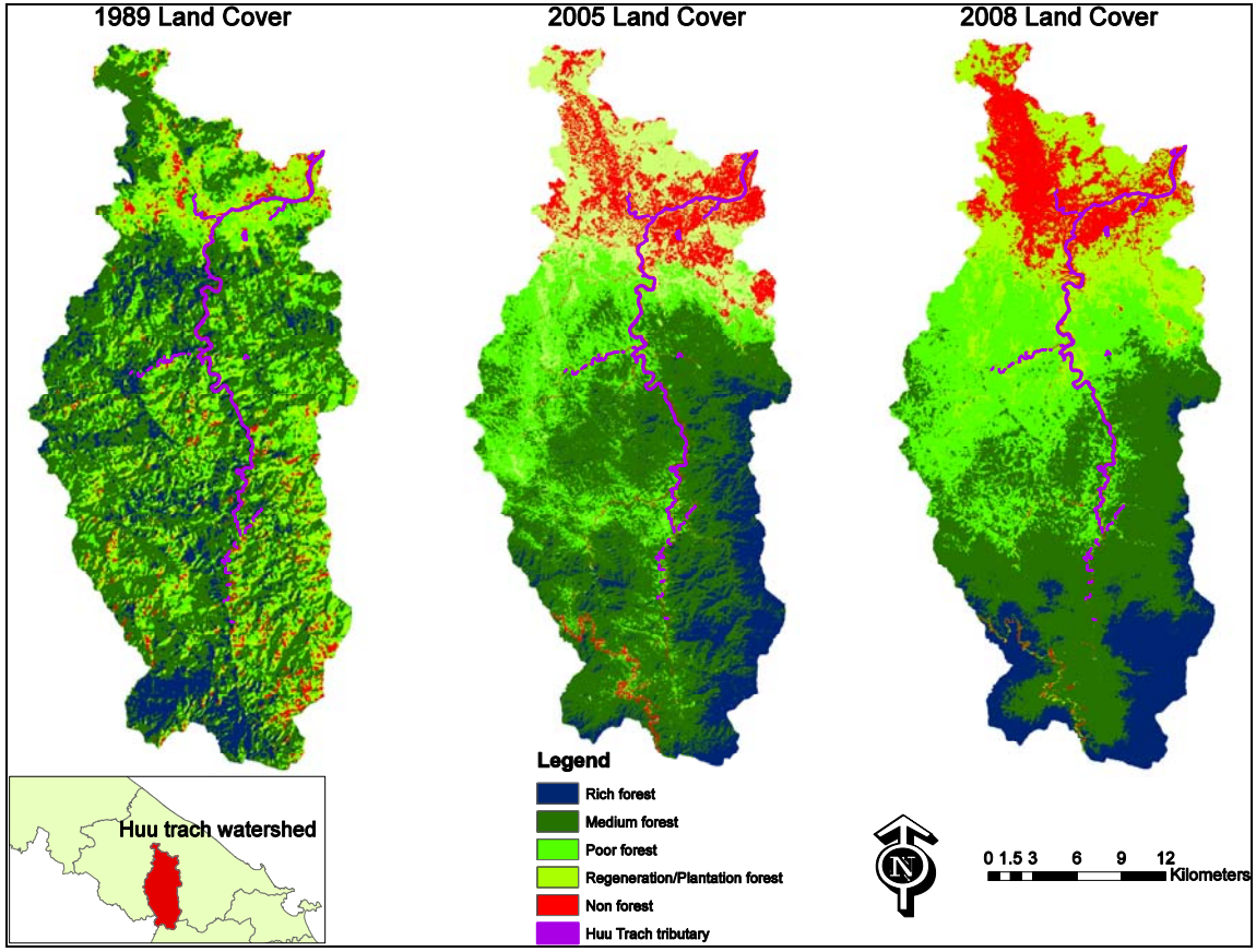
Application of GIS and Remote Sensing for Environment and Flood Risk Management in Central Viet Nam
This project assessed and implemented new methods and reviewed existing methods of categorising land use in the Mekong areas of Viet Nam and the links between flooding and land-use.
Vulnerability assessment of livelihoods in Lower Mekong Basin: Adaptation options for enhancing capacity of people living in the most vulnerable flood-prone areas in Cambodia and Vietnam
Vulnerability assessment of livelihoods in Lower Mekong Basin.
Vulnerability assessment of livelihoods in Lower Mekong Basin: Adaptation options for enhancing capacity of people living in the most vulnerable flood-prone areas in Cambodia and Vietnam
The SUMERNET study used a livelihood vulnerability index (LVI) to analyze five livelihood assets and differences in vulnerability patterns and develop appropriate policies at the provincial level.


