Case-study /
USAID Mekong ARCC Climate Change Impact and Adaptation Study


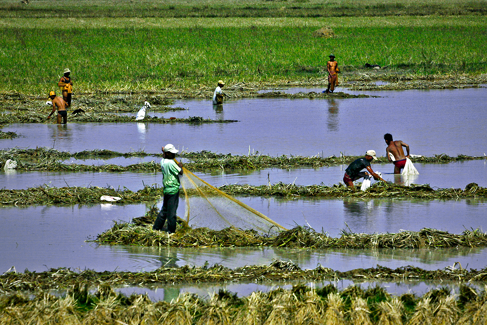
Cambodian communities along the Mekong River earn their living from crops, irrigation, and fisheries. Photo by: Apiwat S
Adaptation context
Flowing from the mountains of Laos to the delta in Vietnam, the Lower Mekong River is the lifeblood for the millions of inhabitants who call the basin home. Their food security, health, and economic livelihoods depend directly on the natural systems and services provided by the Mekong River, particularly for crop irrigation and fisheries.
Extreme weather events, like floods and droughts, as well as shifts in the length of wet season and temperature rises will continue to alter the river flow and its vast tributaries to the livelihood in the basin. These factors will directly affect crop productivity and fish stocks that sustain growing populations and generate revenue for the interlinked economies of the Lower Mekong Basin (LMB) nations.
Project overview
The USAID Mekong ARCC project is a five- year project (2011-2016) funded by the United States Agency for International Development (USAID) Regional Development Mission for Asia (RDMA) in Bangkok and implemented by Development Alternatives Inc. (DAI) in partnership with International Centre for Environmental Management (ICEM) and World Resources Institute (WRI). The project focuses on identifying the environmental, economic, and social effects of climate change in the Lower Mekong Basin (LMB), and on assisting highly exposed and vulnerable rural populations in ecologically sensitive areas increase their ability to adapt to climate change impacts on water resources, agricultural and aquatic systems, livestock, ecosystems, and livelihood options.
Project zones
The study used a spatial approach, working from the overall basin level down to ecozones, catchments, provinces, and protected areas. Basin-wide analysis focused on broad-scale themes such as climate threats and shifting crop suitability. The study defined 12 distinct ecozones consisting of areas of similar climate, ecosystems, and agricultural characteristics and potential. These were chosen rather than agricultural zones as the basic spatial unit for the region because of the need to emphasize the fundamental importance of natural systems and biodiversity in local livelihoods and farming systems.
Objectives
The aim of the Mekong Climate Study is to undertake a climate change vulnerability and adaptation study on the water resources, food security, livelihoods, and biodiversity of the LMB. The study is led by ICEM and the study team is made up of 21 international and regional specialists.
The Mekong Climate Study lays the foundation for the whole USAID Mekong ARCC project by providing the scientific evidence base for identifying highly vulnerable and valuable agricultural and natural systems assets in the LMB. It also defines broad adaptation options and priorities, and guides the selection of focal areas for enhancing existing approaches and demonstrating and testing new adaptation strategies. The study focuses on five themes: i) agriculture, ii) capture fisheries and aquaculture, iii) livestock, iv) natural systems, and v) socio-economics.
The objectives of the Mekong Climate Study are to take an ecosystems approach in:
1. Identifying climate change impact and vulnerabilities of rural poor and their environment – water resources, food security, livelihoods, and biodiversity (plants, fisheries, and wildlife);
2. Identifying hotspots in the LMB and providing a scientific evidence base to guide the selection of pilot project sites;
3. Defining adaptation strategies for the main threats to inform and guide community- and ecosystem-based adaptation pilot projects; and
4. Communicating the results of the vulnerability assessment and adaptation planning.
Addressing other drivers of change in climate change adaptation
The difficulties of discerning climate change influences against the background of development noise were addressed in two ways. The first was to project climate change far enough into the future (i.e., 2050) so its effects stand out against the backdrop of other influences – and then to work back to less distant time slices (e.g., 2030). The second was to identify the main development trends and drivers of change during the baseline assessment and then to ‘park’ that information – to be picked up again and considered during adaptation planning so that integrated responses to a variety of threats can be defined. By following this approach, the impacts and vulnerabilities due to climate change can be defined in isolation without distraction from development forces.
Adaptation options

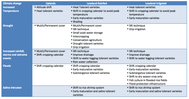
Adaptation options for uplands, lowland rainfed, and lowland irrigated farming systems
